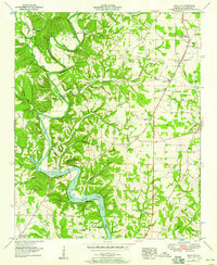
1952 Map of Pruitton
USGS Topo · Published 1958About this map
Wilson Lake dominates the southern portion of this landscape, where the waters of Shoal Creek back up behind the dam into a winding reservoir system. Along the northern banks, the terrain is defined by the steep cuts of Butler Creek and Cowpen Creek, illustrating the complex drainage of Lauderdale County. The Louisville and Nashville railroad cuts through the northwestern corner near Pruitton, while the Jackson Highway serves as the primary north-south artery through Green Hill.
Find a feature on this map
55 named features on this map. Tap any name to fly to it.
Don’t see what you’re looking for? This feature index may not catch every label — zoom into the map to look around manually.
Map Details
Editions of this 1952 Pruitton Map
3 editions found
Other maps of this area

1905 · Waynesboro
USGS Topo · 1:125,000

1914 · Rogersville
USGS Topo · 1:48,000

1914 · Muscle Shoals
USGS Topo · 1:48,000

1916 · Muscle Shoals
USGS Topo · 1:62,500

1916 · Rogersville
USGS Topo · 1:62,500

1936 · Light
USGS Topo · 1:24,000

1936 · Loretto
USGS Topo · 1:24,000

1936 · Pruitton
USGS Topo · 1:24,000

1936 · Wheeler Dam
USGS Topo · 1:24,000

1936 · Florence
USGS Topo · 1:24,000