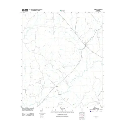
2012 Map of Puckett
USGS Topo · Published 2012About this map
Strong River meanders across the southern landscape of this central Mississippi region, providing a primary drainage point for a network of creeks including Wildcat Cr and Brushy Cr. The settlement of Puckett serves as a local hub, situated at a junction of roads that connect rural homesteads and timberlands. Further south, the community of Everett is positioned near the riverbanks, where Floyd Bridge provides a crossing toward the neighboring woods.
Find a feature on this map
80 named features on this map. Tap any name to fly to it.
Don’t see what you’re looking for? This feature index may not catch every label — zoom into the map to look around manually.
Map Details
Editions of this 2012 Puckett Map
This is the sole edition of this map. No revisions or reprints were ever made.
Other maps of this area

1935 · White Oak
USGS Topo · 1:24,000

1953 · Hattiesburg
USGS Topo · 1:250,000

1953 · Meridian
USGS Topo · 1:250,000

1957 · Meridian
USGS Topo · 1:250,000

1958 · Hattiesburg
USGS Topo · 1:250,000

1965 · Meridian
USGS Topo · 1:250,000
1968 · Puckett NW
USGS Topo · 1:24,000

1968 · White Oak
USGS Topo · 1:24,000
1968 · Puckett
USGS Topo · 1:24,000
1968 · Polkville
USGS Topo · 1:24,000