
1954 Map of Pueblo
USGS Topo · Published 1966About this map
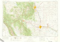
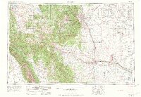
Pikes Peak towers over the western horizon of this mid-century survey, a landmark that defines the sharp transition from the Front Range to the eastern plains. The post-war expansion of Colorado Springs and Pueblo is evident, particularly with the established footprint of the Fort Carson Military Reservation and the sprawling Pueblo Ordnance Depot. Industrial hubs like the Colorado Fuel and Iron Mill and the Empire Zinc Mine reflect the region's reliance on mineral wealth and heavy manufacturing.
Find a feature on this map
247 named features on this map. Tap any name to fly to it.
Don’t see what you’re looking for? This feature index may not catch every label — zoom into the map to look around manually.
Map Details
Editions of this 1954 Pueblo Map
3 editions found
Other maps of this area

1889 · Canon City
USGS Topo · 1:125,000

1889 · Leadville
USGS Topo · 1:125,000

1889 · Huerfano Park
USGS Topo · 1:125,000

1889 · Sanborn
USGS Topo · 1:125,000

1891 · Walsenburg
USGS Topo · 1:125,000

1891 · Sanborn
USGS Topo · 1:125,000

1891 · Catlin
USGS Topo · 1:125,000

1891 · Pueblo
USGS Topo · 1:125,000

1891 · Timpas
USGS Topo · 1:125,000

1891 · Nepesta
USGS Topo · 1:125,000