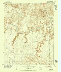
1953 Map of Puente
USGS Topo · Published 1954About this map
Canadian River waters dominate this mid-century Texas Panhandle landscape, where the braided riverbed cuts deeply through the high plains of Potter County. The terrain is characterized by a network of drainage systems like John Ray Creek, Pitcher Creek, and West Amarillo Creek that have carved complex canyons into the surrounding tableland, notably around Indian Fort Mesa. Large cattle operations define the local economy and land use, with the Cross Bar Ranch, Fain Ranch, and Fuqua A Bar Ranch serving as primary landmarks. Transport is limited to the (A T & S F) railroad corridor and the F. M. Highway 1913, which passes the Canadian River Store and a Ford near a Gaging Sta. Numerous Windmill sites are scattered across the ranchlands, indicating the essential role of groundwater in this semi-arid environment during the early 1950s.
Find a feature on this map
27 named features on this map. Tap any name to fly to it.
Don’t see what you’re looking for? This feature index may not catch every label — zoom into the map to look around manually.
Map Details
Editions of this 1953 Puente Map
2 editions found
Other maps of this area

1934 · Ady
USGS Topo · 1:62,500

1934 · Cliffside
USGS Topo · 1:62,500

1936 · Fourways
USGS Topo · 1:62,500

1936 · Cliffside
USGS Topo · 1:62,500

1936 · Ady
USGS Topo · 1:62,500

1953 · Chunky
USGS Topo · 1:24,000

1953 · Marsh
USGS Topo · 1:24,000

1953 · Puente
USGS Topo · 1:24,000

1953 · Pleasant Valley
USGS Topo · 1:24,000

1953 · McDowell Creek
USGS Topo · 1:24,000