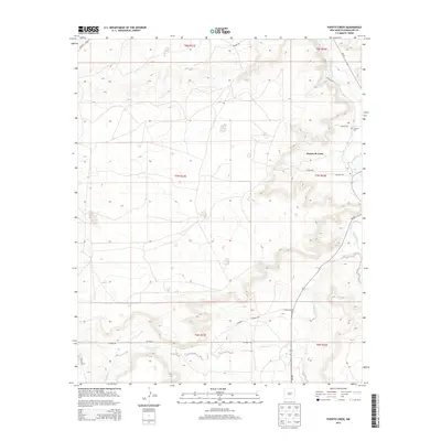
2013 Map of Puerto Creek
USGS Topo · Published 2013About this map
Puerto de Luna occupies the upper reaches of this Guadalupe County landscape, situated where the valley of the Pecos River transitions into the high plains. This 2013 survey illustrates a rural settlement pattern defined by sparse desert outposts and a network of named county roads such as Paisano Rd and Haight Rd. The terrain is deeply incised by drainage systems, most notably Puerto Creek and Carrizo Cr, which flow toward the river corridor in the east. Genealogy researchers may find interest in the Calvoria Cem located near the northeastern boundary, as well as the small cluster at Saiaz further south. The map reflects a landscape where modern infrastructure like NM-91 and NM-203 follows older travel corridors through the arid basin-and-range topography.
Find a feature on this map
25 named features on this map. Tap any name to fly to it.
Don’t see what you’re looking for? This feature index may not catch every label — zoom into the map to look around manually.
Map Details
Editions of this 2013 Puerto Creek Map
This is the sole edition of this map. No revisions or reprints were ever made.
Other maps of this area

1954 · Fort Sumner
USGS Topo · 1:250,000

1958 · Fort Sumner
USGS Topo · 1:250,000

1963 · Santa Rosa
USGS Topo · 1:24,000

1963 · Puerto Creek
USGS Topo · 1:24,000

1963 · Sunshine Mesa
USGS Topo · 1:24,000

1963 · Puerto De Luna
USGS Topo · 1:24,000

1966 · Ojo Negro Creek
USGS Topo · 1:24,000

1966 · Borica
USGS Topo · 1:24,000
1978 · Pastura NE
USGS Topo · 1:24,000

1978 · Laguna De Los Terreros
USGS Topo · 1:24,000