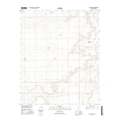
2017 Map of Puerto Creek
USGS Topo · Published 2017About this map
Puerto De Luna sits at the heart of this Guadalupe County landscape, positioned where the high plains break toward the winding valley of the Pecos River. The settlement pattern follows the fertile corridor created by the river and its tributaries, including the namesake Puerto Creek and the southern Carrizo Cr. Cultural landmarks like the Calvoria Cem reflect the long-standing community roots in this region, while a network of rural routes such as Paisano Rd and Pso Del Sol connect isolated ranches and homesteads across the varied terrain. This survey illustrates the relationship between the arid uplands and the essential water resources that have shaped local livestock and agricultural life for generations.
Find a feature on this map
22 named features on this map. Tap any name to fly to it.
Don’t see what you’re looking for? This feature index may not catch every label — zoom into the map to look around manually.
Map Details
Editions of this 2017 Puerto Creek Map
This is the sole edition of this map. No revisions or reprints were ever made.
Other maps of this area

1954 · Fort Sumner
USGS Topo · 1:250,000

1958 · Fort Sumner
USGS Topo · 1:250,000

1963 · Santa Rosa
USGS Topo · 1:24,000

1963 · Puerto Creek
USGS Topo · 1:24,000

1963 · Sunshine Mesa
USGS Topo · 1:24,000

1963 · Puerto De Luna
USGS Topo · 1:24,000

1966 · Ojo Negro Creek
USGS Topo · 1:24,000

1966 · Borica
USGS Topo · 1:24,000
1978 · Pastura NE
USGS Topo · 1:24,000

1978 · Laguna De Los Terreros
USGS Topo · 1:24,000