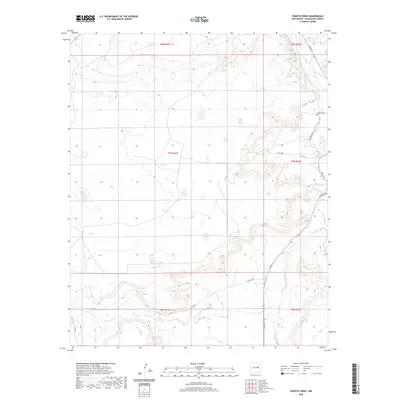
2020 Map of Puerto Creek
USGS Topo · Published 2020About this map
Sunshine Mesa rises above the dramatic drainage basin of the Pecos River in this eastern Guadalupe County landscape. The terrain is defined by the winding course of the river as it flows southward, joined by tributary systems including Puerto Creek and Carrizo Cr. Human presence is marked primarily by a network of rural county routes such as Paisano Rd and Pso Del Sol, which navigate the varying elevations and canyon edges.
Find a feature on this map
23 named features on this map. Tap any name to fly to it.
Don’t see what you’re looking for? This feature index may not catch every label — zoom into the map to look around manually.
Map Details
Editions of this 2020 Puerto Creek Map
This is the sole edition of this map. No revisions or reprints were ever made.
Other maps of this area

1954 · Fort Sumner
USGS Topo · 1:250,000

1958 · Fort Sumner
USGS Topo · 1:250,000

1963 · Santa Rosa
USGS Topo · 1:24,000

1963 · Puerto Creek
USGS Topo · 1:24,000

1963 · Sunshine Mesa
USGS Topo · 1:24,000

1963 · Puerto De Luna
USGS Topo · 1:24,000

1966 · Ojo Negro Creek
USGS Topo · 1:24,000

1966 · Borica
USGS Topo · 1:24,000
1978 · Pastura NE
USGS Topo · 1:24,000

1978 · Laguna De Los Terreros
USGS Topo · 1:24,000