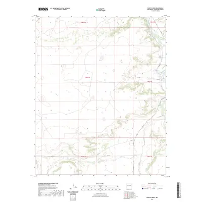
2023 Map of Puerto Creek
USGS Topo · Published 2023About this map
Puerto de Luna serves as the primary settlement hub in this landscape where the high plains meet the river valley. The settlement is situated along the Pecos River, which carves a deep path through the terrain. Evidence of the area's enduring community can be seen at Calvoria Cem to the north, while the landscape is further defined by the seasonal drainage of Puerto Creek and Carrizo Creek. The road network, including Paisano Rd and Pso Del Sol, follows the contours of the land, connecting disparate ranching and rural properties. The U.S. Geological Survey topography reveals a complex system of mesas and arroyos that have historically dictated the placement of trails and small-scale habitation in Guadalupe County.
Find a feature on this map
22 named features on this map. Tap any name to fly to it.
Don’t see what you’re looking for? This feature index may not catch every label — zoom into the map to look around manually.
Map Details
Editions of this 2023 Puerto Creek Map
This is the sole edition of this map. No revisions or reprints were ever made.
Other maps of this area

1954 · Fort Sumner
USGS Topo · 1:250,000

1958 · Fort Sumner
USGS Topo · 1:250,000

1963 · Santa Rosa
USGS Topo · 1:24,000

1963 · Puerto Creek
USGS Topo · 1:24,000

1963 · Sunshine Mesa
USGS Topo · 1:24,000

1963 · Puerto De Luna
USGS Topo · 1:24,000

1966 · Ojo Negro Creek
USGS Topo · 1:24,000

1966 · Borica
USGS Topo · 1:24,000
1978 · Pastura NE
USGS Topo · 1:24,000

1978 · Laguna De Los Terreros
USGS Topo · 1:24,000