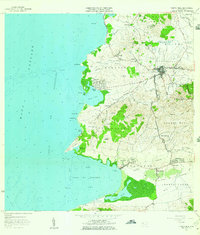
1957 Map of Puerto Real
USGS Topo · Published 1959About this map
The western coastline of Cabo Rojo is defined by a series of prominent points and sheltered bays, from the northern expanse of Laguna Joyuda down to the wide Bahía de Boquerón. This 1957 revision illustrates the established agricultural and coastal economy of the region, featuring a dense network of small settlements such as Joyuda, Berbedere, and Betances. Inland, the terrain rises toward hills like Cerro Piñas and Cerro Algodón, while the coastal flats are marked by the Ferrocarril rail line and the Canal de Riego irrigation system, reflecting the area's developed land use.
Find a feature on this map
70 named features on this map. Tap any name to fly to it.
Don’t see what you’re looking for? This feature index may not catch every label — zoom into the map to look around manually.
Map Details
Editions of this 1957 Puerto Real Map
2 editions found
Other maps of this area

1935 · Puerto Real
USGS Topo · 1:25,000

1937 · San German
USGS Topo · 1:25,000

1937 · Puerto Real
USGS Topo · 1:25,000

1938 · Parguera
USGS Topo · 1:30,000

1938 · Cabo Rojo
USGS Topo · 1:30,000

1939 · Mayaguez
USGS Topo · 1:30,000

1941 · San German
USGS Topo · 1:30,000

1941 · Puerto Real
USGS Topo · 1:30,000

1941 · Rosario
USGS Topo · 1:30,000

1942 · Rosario
USGS Topo · 1:30,000
Featured Places
- Cabo Rojo
- Reparto Vista Verde, Cabo Rojo
- Villa Tortuga, Cabo Rojo
- Sector Souchet, Cabo Rojo
- El Fuego y Las Piedras, Cabo Rojo