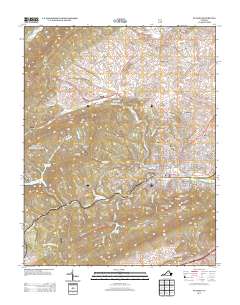
2013 Map of Pulaski
USGS Topo · Published 2013About this map
Pulaski serves as the central hub in this 2013 survey of the Virginia highlands, where a dense grid of streets meets the winding waters of Peak Cr. The town is surrounded by distinct geographical markers such as Little Mountain and Caseknife Ridge, which shape the local development. To the north and west, the landscape transitions into a more rural pattern of scattered settlements and named hollows. Evidence of the region's industrial past is visible at the Empire Mine near Thornhill Pond, while agricultural heritage is noted at the Kegley Farm of Pulaski. The presence of the Gatewood Reservoir and Hogan Lake indicates the importance of managed water resources for the area. Smaller communities like Hilton Village, Weldon, and Bella Vista occupy the valleys between ridges, connected by a network of rural routes including Robinson Tract Rd.
Find a feature on this map
177 named features on this map. Tap any name to fly to it.
Don’t see what you’re looking for? This feature index may not catch every label — zoom into the map to look around manually.
Map Details
Editions of this 2013 Pulaski Map
This is the sole edition of this map. No revisions or reprints were ever made.
Other maps of this area

1889 · Hillsville
USGS Topo · 1:125,000

1890 · Dublin
USGS Topo · 1:125,000

1891 · Dublin
USGS Topo · 1:125,000

1892 · Hillsville
USGS Topo · 1:125,000

1896 · Hillsville
USGS Topo · 1:125,000

1930 · Max Meadows
USGS Topo · 1:62,500

1934 · Pulaski
USGS Topo · 1:48,000

1940 · Pulaski
USGS Topo · 1:62,500

1950 · Radford
USGS Topo · 1:62,500

1953 · Winston-Salem
USGS Topo · 1:250,000