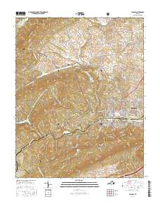
2016 Map of Pulaski
USGS Topo · Published 2016About this map
Pulaski serves as the central hub of this 2016 survey, where the urban grid meets the rising slopes of the Blue Ridge. The landscape is defined by the sharp transition from the valley floor to the prominent ridgelines of Draper Mtn and Caseknife Ridge, which hem in the town to the south. To the west, the expansive Jefferson National Forest covers much of the terrain, protecting landmarks like Chestnut Mtn and the waters of Gatewood Reservoir.
Find a feature on this map
129 named features on this map. Tap any name to fly to it.
Don’t see what you’re looking for? This feature index may not catch every label — zoom into the map to look around manually.
Map Details
Editions of this 2016 Pulaski Map
This is the sole edition of this map. No revisions or reprints were ever made.
Other maps of this area

1889 · Hillsville
USGS Topo · 1:125,000

1890 · Dublin
USGS Topo · 1:125,000

1891 · Dublin
USGS Topo · 1:125,000

1892 · Hillsville
USGS Topo · 1:125,000

1896 · Hillsville
USGS Topo · 1:125,000

1930 · Max Meadows
USGS Topo · 1:62,500

1934 · Pulaski
USGS Topo · 1:48,000

1940 · Pulaski
USGS Topo · 1:62,500

1950 · Radford
USGS Topo · 1:62,500

1953 · Winston-Salem
USGS Topo · 1:250,000