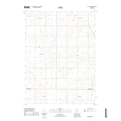
2017 Map of Pullen Ranch
USGS Topo · Published 2017About this map
Pullen Ranch serves as the central namesake landmark in this high-plains landscape situated along the boundary of McPherson and Lincoln Counties. The terrain is defined by the complex undulating contours of the Nebraska Sandhills, where the absence of surface water highlights a reliance on groundwater and isolated ranching operations. Transportation in this sparsely populated region is limited to a handful of designated routes, including Griffith Rd in the north and S Tryon Rd cutting across the northwestern corner. The map provides a detailed view of the Public Land Survey System grid, tracing townships such as t17n r32w and t17n r31w, which organize the vast grazing lands. This 2017 survey reflects the enduring character of the Sandhills, where large-scale land holdings and wide-open spaces remain the primary geographic features.
Find a feature on this map
11 named features on this map. Tap any name to fly to it.
Don’t see what you’re looking for? This feature index may not catch every label — zoom into the map to look around manually.
Map Details
Editions of this 2017 Pullen Ranch Map
This is the sole edition of this map. No revisions or reprints were ever made.
Other maps of this area

1898 · Paxton
USGS Topo · 1:125,000

1899 · North Platte
USGS Topo · 1:125,000

1901 · Paxton
USGS Topo · 1:125,000

1902 · North Platte
USGS Topo · 1:125,000

1949 · Wright Valley
USGS Topo · 1:62,500

1951 · Tryon
USGS Topo · 1:62,500

1951 · Wright Valley
USGS Topo · 1:62,500

1954 · North Platte
USGS Topo · 1:250,000

1956 · North Platte
USGS Topo · 1:250,000

1957 · North Platte
USGS Topo · 1:250,000