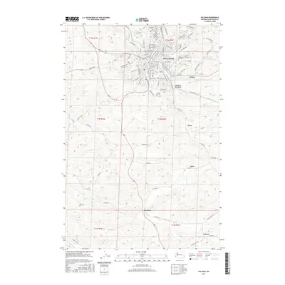
2017 Map of Pullman
USGS Topo · Published 2017About this map
Washington State Univ anchors the northern portion of this survey, surrounded by the dense street grid of Pullman. The university grounds and the surrounding residential sectors like NE Stadium Way and NE Campus St define the urban center, while the S Fork Palouse River and Paradise Cr converge nearby. Just south of the main city, the terrain transitions into a series of smaller agricultural hubs and rail-aligned settlements. Notable locations include Pullman Junction, Whitlow, and Busby, each marking points of historical transit and commerce in Whitman County.
Find a feature on this map
103 named features on this map. Tap any name to fly to it.
Don’t see what you’re looking for? This feature index may not catch every label — zoom into the map to look around manually.
Map Details
Editions of this 2017 Pullman Map
This is the sole edition of this map. No revisions or reprints were ever made.
Other maps of this area

1910 · Pullman
USGS Topo · 1:125,000

1955 · Pullman
USGS Topo · 1:250,000

1958 · Pullman
USGS Topo · 1:250,000

1964 · Viola
USGS Topo · 1:24,000

1964 · Moscow West
USGS Topo · 1:24,000

1964 · Colton
USGS Topo · 1:24,000
1964 · Albion
USGS Topo · 1:24,000

1964 · Colfax South
USGS Topo · 1:24,000

1964 · Ewartsville
USGS Topo · 1:24,000

1964 · Bishop
USGS Topo · 1:24,000