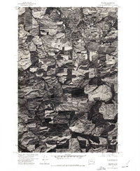
1975 Map of Pullman
USGS Topo · Published 1977About this map
The South Fork Palouse River winds through this agricultural landscape of the Palouse region, captured here during the mid-1970s. This orthophotograph map, produced in cooperation with the Soil Conservation Service, uses aerial imagery to reveal the complex patterns of cultivation and drainage across the rolling terrain. The city of Pullman serves as the primary hub, showing its urban footprint and the distinct grid of the university and surrounding neighborhoods. To the south, smaller rural clusters like Staley and Johnson are visible, connected by a network of roads that follow the natural contours and property boundaries of the wheat-growing hills. The imagery provides a clear view of land use and the density of development at the time the photographs were taken in September 1975.
Find a feature on this map
4 named features on this map. Tap any name to fly to it.
Don’t see what you’re looking for? This feature index may not catch every label — zoom into the map to look around manually.
Map Details
Editions of this 1975 Pullman Map
This is the sole edition of this map. No revisions or reprints were ever made.
Other maps of this area

1910 · Pullman
USGS Topo · 1:125,000

1955 · Pullman
USGS Topo · 1:250,000

1958 · Pullman
USGS Topo · 1:250,000

1964 · Viola
USGS Topo · 1:24,000

1964 · Moscow West
USGS Topo · 1:24,000

1964 · Colton
USGS Topo · 1:24,000
1964 · Albion
USGS Topo · 1:24,000

1964 · Colfax South
USGS Topo · 1:24,000

1964 · Ewartsville
USGS Topo · 1:24,000

1964 · Bishop
USGS Topo · 1:24,000