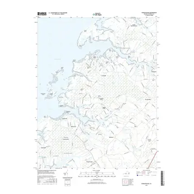
2016 Map of Pungoteague
USGS Topo · Published 2016About this map
The complex shoreline of Virginia’s Eastern Shore is defined here by a intricate network of necks and marshes reaching into the Chesapeake Bay. Settlement patterns follow the high ground between tidal inlets, with historic communities like Pungoteague, Savageville, and Onancock serving as anchors for the surrounding rural landscape. The map provides significant detail for genealogists, identifying family-linked landmarks such as the Addison Plot Cem, Ames Hacks Neck Cem, and Badger Savage Cem.
Find a feature on this map
152 named features on this map. Tap any name to fly to it.
Don’t see what you’re looking for? This feature index may not catch every label — zoom into the map to look around manually.
Map Details
Editions of this 2016 Pungoteague Map
This is the sole edition of this map. No revisions or reprints were ever made.
Other maps of this area

1903 · Crisfield
USGS Topo · 1:62,500

1920 · Crisfield
USGS Topo · 1:62,500

1931 · Accomac
USGS Topo · 1:48,000

1935 · Accomac
USGS Topo · 1:62,500

1942 · Chesconessex
USGS Topo · 1:31,680

1942 · Nandua Creek
USGS Topo · 1:24,000

1942 · Tangier Island
USGS Topo · 1:24,000

1942 · Parksley
USGS Topo · 1:24,000

1943 · Jamesville
USGS Topo · 1:31,680

1943 · Pungoteague
USGS Topo · 1:31,680