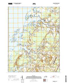
2019 Map of Pungoteague
USGS Topo · Published 2019About this map
The complex shoreline of the Eastern Shore's Chesapeake side defines this region, where the tidal fingers of Onancock Creek and Pungoteague Creek reach deep into the farmland of Accomack County. This landscape is a patchwork of ancient necks and points, such as Slutkill Neck and Ames-Hacks Neck, which have dictated the layout of coastal settlements for generations. The interior is dotted with small, historically distinct communities like Crockett Town, Savageville, and Pungoteague, many centered around family-named landmarks and rural burial grounds such as the Badger-Savage Cem. Moving inland, the terrain transitions into protected natural areas like the Dahl Swamp and the tidal marshes of Parkers Marsh, while modern infrastructure is represented by the Accomack County Airport and the Eastern Shore Community College campus near Keller. The intricate drainage network, including Leatherberry Creek and Finneys Creek, illustrates the enduring relationship between the peninsula's agricultural life and its maritime geography.
Find a feature on this map
164 named features on this map. Tap any name to fly to it.
Don’t see what you’re looking for? This feature index may not catch every label — zoom into the map to look around manually.
Map Details
Editions of this 2019 Pungoteague Map
This is the sole edition of this map. No revisions or reprints were ever made.
Other maps of this area

1903 · Crisfield
USGS Topo · 1:62,500

1920 · Crisfield
USGS Topo · 1:62,500

1931 · Accomac
USGS Topo · 1:48,000

1935 · Accomac
USGS Topo · 1:62,500

1942 · Chesconessex
USGS Topo · 1:31,680

1942 · Nandua Creek
USGS Topo · 1:24,000

1942 · Tangier Island
USGS Topo · 1:24,000

1942 · Parksley
USGS Topo · 1:24,000

1943 · Jamesville
USGS Topo · 1:31,680

1943 · Pungoteague
USGS Topo · 1:31,680