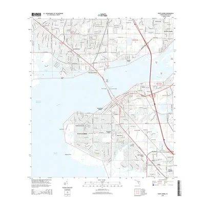
2015 Map of Punta Gorda
USGS Topo · Published 2015About this map
Punta Gorda and Port Charlotte flank the wide mouth of the Peace River in this 2015 U.S. Geological Survey representation of Charlotte County. The map details a landscape defined by intricate canal systems and coastal residential developments, including Punta Gorda Isles and Riviera Lagoons. This modern survey illustrates the high degree of late-20th and early-21st-century coastal engineering, where man-made waterways like the Morningstar Canal Bridge and Sunset Canal Bridge facilitate inland navigation. Across the water, the settlement of Harbour Heights and the waterfront commerce of Fishermens Village highlight the regional reliance on the harbor. Genealogical and local interest points include the Indian Springs Cem near Acline and the campus of Edison College Charlotte, while markers like Grassy Point and Live Oak Point indicate the natural shoreline features remaining amidst the suburban growth.
Find a feature on this map
49 named features on this map. Tap any name to fly to it.
Don’t see what you’re looking for? This feature index may not catch every label — zoom into the map to look around manually.
Map Details
Editions of this 2015 Punta Gorda Map
This is the sole edition of this map. No revisions or reprints were ever made.
Other maps of this area

1956 · Murdock
USGS Topo · 1:24,000

1956 · Murdock SE
USGS Topo · 1:24,000

1956 · Cleveland
USGS Topo · 1:24,000

1956 · Ft. Ogden
USGS Topo · 1:24,000

1956 · Punta Gorda SE
USGS Topo · 1:24,000

1956 · West Palm Beach
USGS Topo · 1:250,000

1956 · Tampa
USGS Topo · 1:250,000

1956 · Fort Pierce
USGS Topo · 1:250,000

1956 · Charlotte Harbor
USGS Topo · 1:250,000

1957 · West Palm Beach
USGS Topo · 1:250,000