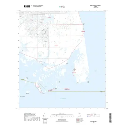
2018 Map of Punta Gorda SW
USGS Topo · Published 2018About this map
The tidal marshes and barrier islands of the Florida Gulf coast define this landscape, where the Charlotte Co Lee Co boundary cuts through the expansive Gasparilla Sound. Several significant archaeological and shell mound sites are documented throughout the islands and mangrove keys, including Mound Key, Cash Mound, and John Quiet Mound. These features, along with names like Devilfish Key and Cayo Pelau, speak to the deep indigenous and maritime history of the region.
Find a feature on this map
65 named features on this map. Tap any name to fly to it.
Don’t see what you’re looking for? This feature index may not catch every label — zoom into the map to look around manually.
Map Details
Editions of this 2018 Punta Gorda SW Map
This is the sole edition of this map. No revisions or reprints were ever made.
Other maps of this area

1956 · Punta Gorda SE
USGS Topo · 1:24,000

1956 · Englewood
USGS Topo · 1:24,000

1956 · Tampa
USGS Topo · 1:250,000

1956 · Charlotte Harbor
USGS Topo · 1:250,000

1957 · El Jobean
USGS Topo · 1:24,000

1957 · Punta Gorda SW
USGS Topo · 1:24,000

1957 · Punta Gorda
USGS Topo · 1:24,000

1957 · Placida
USGS Topo · 1:24,000

1958 · Matlacha
USGS Topo · 1:24,000

1958 · Port Boca Grande
USGS Topo · 1:24,000