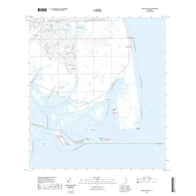
2021 Map of Punta Gorda SW
USGS Topo · Published 2021About this map
Charlotte Harbor Preserve State Park dominates the coastal landscape of this 2021 survey, showcasing a complex network of wetlands and mangrove-lined waterways. The sheet captures the intricate geography of the southwestern Florida coast, where Gasparilla Sound and Charlotte Harbor meet. Evidence of early habitation is visible through named archaeological sites such as Mound Key, Cash Mound, and John Quiet Mound, which rise above the surrounding tidal flats.
Find a feature on this map
77 named features on this map. Tap any name to fly to it.
Don’t see what you’re looking for? This feature index may not catch every label — zoom into the map to look around manually.
Map Details
Editions of this 2021 Punta Gorda SW Map
This is the sole edition of this map. No revisions or reprints were ever made.
Other maps of this area

1956 · Punta Gorda SE
USGS Topo · 1:24,000

1956 · Englewood
USGS Topo · 1:24,000

1956 · Tampa
USGS Topo · 1:250,000

1956 · Charlotte Harbor
USGS Topo · 1:250,000

1957 · El Jobean
USGS Topo · 1:24,000

1957 · Punta Gorda SW
USGS Topo · 1:24,000

1957 · Punta Gorda
USGS Topo · 1:24,000

1957 · Placida
USGS Topo · 1:24,000

1958 · Matlacha
USGS Topo · 1:24,000

1958 · Port Boca Grande
USGS Topo · 1:24,000