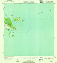
1952 Map of Punta Puerca
USGS Topo · Published 1953About this map
The Naval Reservation dominates this coastal landscape in the municipality of Ceiba, where the Caribbean Sea meets the Atlantic. Detailed topography shows the intricate shoreline from Pta Figueras south to Cabra de Tierra, encompassing the deep waters of Ensenada Honda and the sheltered Bahía de Puerca. This 1952 revision, based on earlier aerial photography, illustrates the strategic and maritime importance of the region during the mid-century.
Find a feature on this map
23 named features on this map. Tap any name to fly to it.
Don’t see what you’re looking for? This feature index may not catch every label — zoom into the map to look around manually.
Map Details
Editions of this 1952 Punta Puerca Map
2 editions found
Other maps of this area

1943 · Island Of Vieques
USGS Topo · 1:30,000

1945 · Cayo Icacos
USGS Topo · 1:30,000

1946 · Punta Puerca
USGS Topo · 1:30,000

1946 · Naguabo
USGS Topo · 1:30,000

1946 · Fajardo
USGS Topo · 1:30,000

1947 · Naguabo NE
USGS Topo · 1:10,000

1951 · Island Of Vieques
USGS Topo · 1:30,000
1952 · Cayo Icacos
USGS Topo · 1:30,000

1952 · Punta Puerca
USGS Topo · 1:30,000
1952 · Naguabo
USGS Topo · 1:30,000