
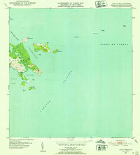
1952 Map of Punta Puerca
USGS Topo · Published 1953About this map
The coastal headland of Punta Puerca and the strategic waters of the Vieques Passage define this 1952 topographic survey of the Ceiba coastline. Much of the terrestrial landscape is dominated by the Naval Reservation Machos, a military footprint established during a period of significant naval expansion in the Caribbean. Along the shoreline, navigational aids like the Faro lighthouse on Isla Cabras mark the entrance to protected waters such as Ensenada Honda and Bahía de Puerca.
Find a feature on this map
21 named features on this map. Tap any name to fly to it.
Don’t see what you’re looking for? This feature index may not catch every label — zoom into the map to look around manually.
Map Details
Editions of this 1952 Punta Puerca Map
2 editions found
Other maps of this area

1943 · Island Of Vieques
USGS Topo · 1:30,000

1945 · Cayo Icacos
USGS Topo · 1:30,000

1946 · Punta Puerca
USGS Topo · 1:30,000

1946 · Naguabo
USGS Topo · 1:30,000

1946 · Fajardo
USGS Topo · 1:30,000

1947 · Naguabo NE
USGS Topo · 1:10,000

1951 · Island Of Vieques
USGS Topo · 1:30,000
1952 · Cayo Icacos
USGS Topo · 1:30,000
1952 · Naguabo
USGS Topo · 1:30,000
1952 · Fajardo
USGS Topo · 1:30,000