
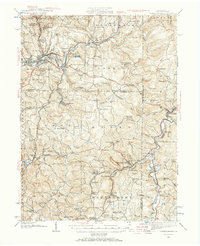
1939 Map of Punxsutawney
USGS Topo · Published 1957About this map
Mahoning Creek and its complex tributaries carve through this Western Pennsylvania landscape, which is defined by a dense network of early 20th-century rural infrastructure. Centered on Punxsutawney, the region is dotted with numerous neighborhood schools such as Harmony Thomas Sch and Dowler Jane Sch, reflecting the localized settlement patterns of Jefferson, Indiana, and Clearfield counties. The industrial character of the era is evidenced by the intersection of the Baltimore and Ohio RR, New York Central RR, and Pennsylvania RR, which supported the local coal and timber economies.
Find a feature on this map
133 named features on this map. Tap any name to fly to it.
Don’t see what you’re looking for? This feature index may not catch every label — zoom into the map to look around manually.
Map Details
Editions of this 1939 Punxsutawney Map
2 editions found
Other maps of this area

1902 · Indiana
USGS Topo · 1:62,500

1902 · Patton
USGS Topo · 1:62,500

1902 · Barnesboro
USGS Topo · 1:62,500

1903 · Curwensville
USGS Topo · 1:62,500

1904 · Barnesboro
USGS Topo · 1:62,500

1904 · Patton
USGS Topo · 1:62,500

1906 · Punxsutawney
USGS Topo · 1:62,500

1909 · Smicksburg
USGS Topo · 1:62,500

1922 · Du Bois
USGS Topo · 1:62,500

1924 · Du Bois
USGS Topo · 1:62,500