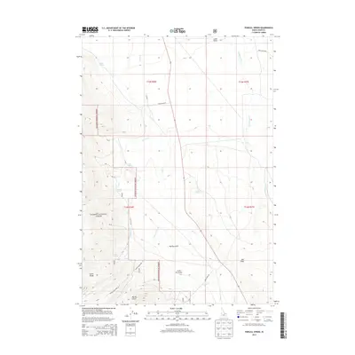
2013 Map of Purcell Spring
USGS Topo · Published 2013About this map
Salmon National Forest defines the western reaches of this high-altitude landscape, where the foothills of the Lemhi Range meet the broad Lemhi Valley. This 2013 survey illustrates a terrain dominated by drainage systems and natural water sources, including the namesake Purcell Spring and several others such as Warm Springs, Cold Spring, and Poison Spring. These springs and seasonal watercourses like Texas Cr and Eighteenmile Cr were essential markers for early settlers and travelers navigating the high desert environment of eastern Idaho.
Find a feature on this map
26 named features on this map. Tap any name to fly to it.
Don’t see what you’re looking for? This feature index may not catch every label — zoom into the map to look around manually.
Map Details
Editions of this 2013 Purcell Spring Map
This is the sole edition of this map. No revisions or reprints were ever made.
Other maps of this area

1955 · Dubois
USGS Topo · 1:250,000

1956 · Leadore
USGS Topo · 1:62,500

1956 · Morrison Lake
USGS Topo · 1:62,500

1956 · Nicholia
USGS Topo · 1:62,500

1957 · Gilmore
USGS Topo · 1:62,500

1958 · Dubois
USGS Topo · 1:250,000

1980 · Leadore
USGS Topo · 1:100,000

1987 · Gilmore
USGS Topo · 1:24,000
1987 · West of Leadore
USGS Topo · 1:24,000

1987 · Purcell Spring
USGS Topo · 1:24,000