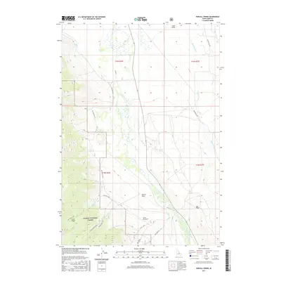
2017 Map of Purcell Spring
USGS Topo · Published 2017About this map
The Lemhi Range rises steeply in the southwestern corner of this Idaho study, where the Salmon National Forest boundary protects the high-altitude watershed of the Nez Perce Creek. This high-desert landscape is defined by its vital water sources, including the namesake Purcell Spring, Warm Springs, and Cold Spring, which provide critical moisture to an otherwise arid terrain. The drainage patterns are clearly established by Texas Creek and Eighteenmile Cr as they move toward the broader Lemhi Valley.
Find a feature on this map
36 named features on this map. Tap any name to fly to it.
Don’t see what you’re looking for? This feature index may not catch every label — zoom into the map to look around manually.
Map Details
Editions of this 2017 Purcell Spring Map
This is the sole edition of this map. No revisions or reprints were ever made.
Other maps of this area

1955 · Dubois
USGS Topo · 1:250,000

1956 · Leadore
USGS Topo · 1:62,500

1956 · Morrison Lake
USGS Topo · 1:62,500

1956 · Nicholia
USGS Topo · 1:62,500

1957 · Gilmore
USGS Topo · 1:62,500

1958 · Dubois
USGS Topo · 1:250,000

1980 · Leadore
USGS Topo · 1:100,000

1987 · Gilmore
USGS Topo · 1:24,000
1987 · West of Leadore
USGS Topo · 1:24,000

1987 · Purcell Spring
USGS Topo · 1:24,000