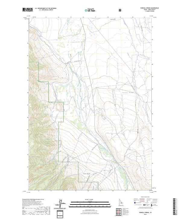
2023 Map of Purcell Spring
USGS Topo · Published 2023About this map
Texas Creek and Eighteenmile Creek define the hydrologic character of this Lemhi County landscape, where the wide floor of the Lemhi Valley meets the rising slopes of the Lemhi Range. This 2023 survey provides a modern view of the southeastern corner of the Salmon National Forest, showing a network of forest development roads and primitive tracks like Nat For Dev Rd 212 and the Nez Perce Lake Trl. The geography is defined by a series of springs and gulches, including Purcell Spring, Poison Spring, and Big Dry Gulch, which serve as critical water sources in this high-elevation environment. Land management boundaries are clearly marked, illustrating the transition from public forest lands to the surrounding ranching and valley tracts, with significant landmarks like Center Ridge providing topographic orientation for researchers and land managers alike.
Find a feature on this map
42 named features on this map. Tap any name to fly to it.
Don’t see what you’re looking for? This feature index may not catch every label — zoom into the map to look around manually.
Map Details
Editions of this 2023 Purcell Spring Map
This is the sole edition of this map. No revisions or reprints were ever made.
Other maps of this area

1955 · Dubois
USGS Topo · 1:250,000

1956 · Leadore
USGS Topo · 1:62,500

1956 · Morrison Lake
USGS Topo · 1:62,500

1956 · Nicholia
USGS Topo · 1:62,500

1957 · Gilmore
USGS Topo · 1:62,500

1958 · Dubois
USGS Topo · 1:250,000

1980 · Leadore
USGS Topo · 1:100,000

1987 · Gilmore
USGS Topo · 1:24,000
1987 · West of Leadore
USGS Topo · 1:24,000

1987 · Purcell Spring
USGS Topo · 1:24,000