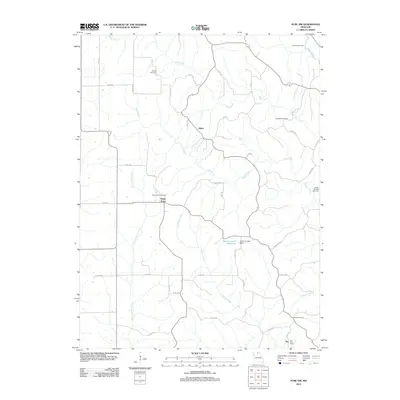
2012 Map of Pure Air
USGS Topo · Published 2012About this map
Ringo Point and the tiny settlement of Zig anchor this rural landscape in western Adair County, where a network of gravel roads and creek valleys defines the local geography. The area's history is tied closely to small-scale extraction and early commerce, evidenced by the central concentration of Mines and the presence of the Zig Post Office in the southern reaches. The map is particularly rich in genealogical data, preserving the locations of numerous family-named burial grounds including Broyles Cemetery, Daniels Cemetery, and Pratt Cemetery. A complex drainage system of named waterways like Hog Creek, Little Mussel Creek, and Billy Creek feeds into the local topography, while human engineering is visible at the Mononame 9 Reservoir and Eschman Lake Dam.
Find a feature on this map
50 named features on this map. Tap any name to fly to it.
Don’t see what you’re looking for? This feature index may not catch every label — zoom into the map to look around manually.
Map Details
Editions of this 2012 Pure Air Map
This is the sole edition of this map. No revisions or reprints were ever made.
Other maps of this area

1911 · Queen City
USGS Topo · 1:62,500

1912 · Green City
USGS Topo · 1:62,500

1913 · Queen City
USGS Topo · 1:62,500

1914 · Green City
USGS Topo · 1:62,500

1938 · Kirksville
USGS Topo · 1:62,500

1940 · Kirksville
USGS Topo · 1:62,500

1954 · Centerville
USGS Topo · 1:250,000

1957 · Centerville
USGS Topo · 1:250,000

1958 · Centerville
USGS Topo · 1:250,000

1963 · Pure Air
USGS Topo · 1:24,000