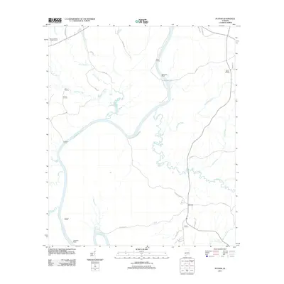
2011 Map of Putnam
USGS Topo · Published 2011About this map
Putnam serves as the primary settlement center in this 2011 survey of Marengo County, Alabama, situated east of the winding Tombigbee River. The river's influence on the landscape is evident through several river-access points like Tuscahoma Landing, Democrat Landing, and Waters Landing, which trace the edge of Coffeeville Lake. These landings reflect a long-standing relationship with the water, serving as historical touchpoints for river navigation and local trade.
Find a feature on this map
44 named features on this map. Tap any name to fly to it.
Don’t see what you’re looking for? This feature index may not catch every label — zoom into the map to look around manually.
Map Details
Editions of this 2011 Putnam Map
This is the sole edition of this map. No revisions or reprints were ever made.
Other maps of this area

1953 · Montgomery
USGS Topo · 1:250,000

1953 · Andalusia
USGS Topo · 1:250,000

1953 · Hattiesburg
USGS Topo · 1:250,000

1953 · Meridian
USGS Topo · 1:250,000

1956 · Montgomery
USGS Topo · 1:250,000

1957 · Meridian
USGS Topo · 1:250,000

1957 · Montgomery
USGS Topo · 1:250,000

1957 · Andalusia
USGS Topo · 1:250,000

1958 · Hattiesburg
USGS Topo · 1:250,000

1965 · Meridian
USGS Topo · 1:250,000