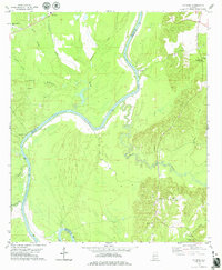
1978 Map of Putnam
USGS Topo · Published 1979About this map
The Tombigbee River and the waters of Coffeeville Lake define this rural landscape along the border of Marengo and Choctaw Counties. This late-1970s survey captures a region where the river remains the primary geographic anchor, punctuated by river-access points like Tuscahoma Landing. On the eastern side of the quadrangle, the community of Putnam serves as a local hub, surrounded by family-named landmarks such as Gooden Hill and the Putnam Cem.
Find a feature on this map
28 named features on this map. Tap any name to fly to it.
Don’t see what you’re looking for? This feature index may not catch every label — zoom into the map to look around manually.
Map Details
Editions of this 1978 Putnam Map
This is the sole edition of this map. No revisions or reprints were ever made.
Other maps of this area

1953 · Montgomery
USGS Topo · 1:250,000

1953 · Andalusia
USGS Topo · 1:250,000

1953 · Hattiesburg
USGS Topo · 1:250,000

1953 · Meridian
USGS Topo · 1:250,000

1956 · Montgomery
USGS Topo · 1:250,000

1957 · Meridian
USGS Topo · 1:250,000

1957 · Montgomery
USGS Topo · 1:250,000

1957 · Andalusia
USGS Topo · 1:250,000

1958 · Hattiesburg
USGS Topo · 1:250,000

1965 · Meridian
USGS Topo · 1:250,000