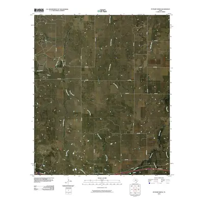
2010 Map of Putnam North
USGS Topo · Published 2010About this map
Putnam occupies the southern edge of this landscape, situated along a transportation corridor defined by the I-20 Access Rd and the crossing of Battle Creek. The surrounding area is a network of rural county roads that follow the divides between several significant drainage systems. To the northwest, the Hart Cemetery stands as a focal point for family history, located near the headwaters of Sheep Creek and Deep Creek. The terrain is deeply etched by a series of north-flowing tributaries including Lovelady Creek, Live Oak Creek, and Post Oak Creek, which create a complex system of draws and branches. This drainage pattern suggests a landscape primarily dedicated to ranching or large-scale agriculture, where the placement of stock tanks and the winding paths of roads like FM 880 and McKinney Rd respond to the natural topography of Callahan County.
Find a feature on this map
31 named features on this map. Tap any name to fly to it.
Don’t see what you’re looking for? This feature index may not catch every label — zoom into the map to look around manually.
Map Details
Editions of this 2010 Putnam North Map
This is the sole edition of this map. No revisions or reprints were ever made.
Other maps of this area

1892 · Albany
USGS Topo · 1:125,000

1893 · Albany
USGS Topo · 1:125,000

1931 · Baird
USGS Topo · 1:125,000

1932 · Baird
USGS Topo · 1:125,000

1954 · Abilene
USGS Topo · 1:250,000

1958 · Abilene
USGS Topo · 1:250,000
1965 · Snyder Lake
USGS Topo · 1:24,000

1965 · Indian Knoll
USGS Topo · 1:24,000
1965 · Moran
USGS Topo · 1:24,000

1966 · Scranton
USGS Topo · 1:24,000