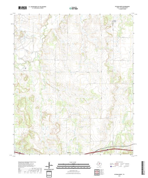
2022 Map of Putnam North
USGS Topo · Published 2022About this map
Putnam sits at the southern edge of this West Texas landscape, positioned along the transportation corridor that includes the I-20 Access Rd and FM 2945. The surrounding terrain in Callahan County is defined by a dense network of intermittent drainages, including Lovelady Cr and Post Oak Cr, which carve through the ranch land. These waterways converge toward Battle Cr in the southeast, illustrating the natural drainage patterns of the region. For those tracing family history, the Hart Cem is a significant waypoint located in the northwest near Sheep Cr. The presence of the Mission Mountain Airport in the northeast corner highlights the modern utility of this expansive landscape, while the intricate grid of county roads like Co RD 315 and Co RD 317 provides a clear view of contemporary land divisions and property access.
Find a feature on this map
31 named features on this map. Tap any name to fly to it.
Don’t see what you’re looking for? This feature index may not catch every label — zoom into the map to look around manually.
Map Details
Editions of this 2022 Putnam North Map
This is the sole edition of this map. No revisions or reprints were ever made.
Other maps of this area

1892 · Albany
USGS Topo · 1:125,000

1893 · Albany
USGS Topo · 1:125,000

1931 · Baird
USGS Topo · 1:125,000

1932 · Baird
USGS Topo · 1:125,000

1954 · Abilene
USGS Topo · 1:250,000

1958 · Abilene
USGS Topo · 1:250,000
1965 · Snyder Lake
USGS Topo · 1:24,000

1965 · Indian Knoll
USGS Topo · 1:24,000
1965 · Moran
USGS Topo · 1:24,000

1966 · Scranton
USGS Topo · 1:24,000