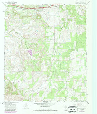
1966 Map of Putnam South
USGS Topo · Published 1987About this map
Putnam serves as the primary hub of this Callahan County landscape, situated along the Union Pacific railroad corridor. The area exhibits a pattern of rural industry, characterized by a sprawling Oil Field and scattered Oil Wells that indicate the subterranean economy of the mid-20th century. Terrain features are defined by numerous drainage systems, including the southward-flowing Battle Creek and the meandering Brushy Creek, which carve through the undulating Texas plains. Further south, the small community of Atwell represents the quieter agricultural character of the region. Transportation and infrastructure are highlighted by a dedicated Landing Strip and multiple Pipelines, reflecting the specialized logistical needs of the local energy and ranching sectors during the 1960s and 1980s.
Find a feature on this map
16 named features on this map. Tap any name to fly to it.
Don’t see what you’re looking for? This feature index may not catch every label — zoom into the map to look around manually.
Map Details
Editions of this 1966 Putnam South Map
2 editions found
Other maps of this area

1931 · Baird
USGS Topo · 1:125,000

1932 · Baird
USGS Topo · 1:125,000

1954 · Abilene
USGS Topo · 1:250,000

1958 · Abilene
USGS Topo · 1:250,000

1966 · Scranton
USGS Topo · 1:24,000

1966 · Putnam South
USGS Topo · 1:24,000
1966 · Bernie Lake
USGS Topo · 1:24,000

1966 · Admiral
USGS Topo · 1:24,000
1966 · Putnam North
USGS Topo · 1:24,000
1966 · Jayell
USGS Topo · 1:24,000