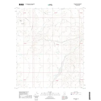
2018 Map of Putnam Wash
USGS Topo · Published 2018About this map
The Tortilla Mountains define this arid landscape in Pinal County, where drainage systems like Putnam Wash and Bloodsucker Wash carve through the high desert terrain. Water management is central to the area's utility, evidenced by localized features such as Antelope Tank, Cowhead Tank, and the isolated Putnam Spring. The Arizona National Scenic Trail traverses the region, threading through canyons and over ridges, providing a modern connection across this historically remote corridor. Named after the historic military site to the south, Camp Grant Wash serves as a major geographical marker, cutting a broad path toward the Gila River valley. The presence of Antelope Peak and several minor washes like James Wash and Palmer Wash illustrate the complex topography that has historically challenged travelers and stockmen alike in this corner of the Southwest.
Find a feature on this map
24 named features on this map. Tap any name to fly to it.
Don’t see what you’re looking for? This feature index may not catch every label — zoom into the map to look around manually.
Map Details
Editions of this 2018 Putnam Wash Map
This is the sole edition of this map. No revisions or reprints were ever made.
Other maps of this area

1911 · Winkelman
USGS Topo · 1:125,000

1913 · Winkelman
USGS Topo · 1:125,000

1948 · Mammoth
USGS Topo · 1:62,500

1948 · Mammoth
USGS Topo · 1:24,000

1949 · Mammoth
USGS Topo · 1:24,000

1949 · Holy Joe Peak
USGS Topo · 1:62,500

1949 · Crozier Peak
USGS Topo · 1:24,000

1949 · Winkelman
USGS Topo · 1:24,000

1949 · Winkelman
USGS Topo · 1:62,500

1949 · Saddle Mtn.
USGS Topo · 1:24,000