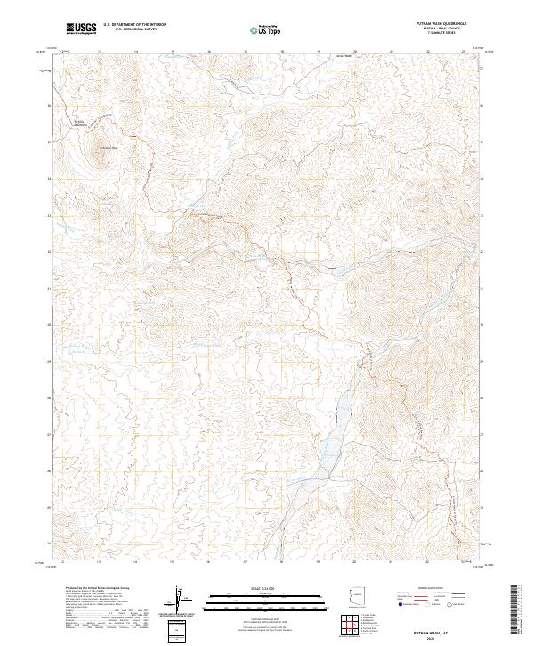
2021 Map of Putnam Wash
USGS Topo · Published 2021About this map
Antelope Peak stands as the dominant topographical feature of this desert landscape, anchored within the Tortilla Mountains. This arid region in Pinal County is defined by an intricate network of seasonal drainages, including the prominent Putnam Wash and Bloodsucker Wash, which carve through the basin and range terrain. The presence of Putnam Spring and man-made water catchments like Antelope Tank and Cowhead Tank underscore the critical importance of water management for ranching and wildlife in this environment.
Find a feature on this map
24 named features on this map. Tap any name to fly to it.
Don’t see what you’re looking for? This feature index may not catch every label — zoom into the map to look around manually.
Map Details
Editions of this 2021 Putnam Wash Map
This is the sole edition of this map. No revisions or reprints were ever made.
Other maps of this area

1911 · Winkelman
USGS Topo · 1:125,000

1913 · Winkelman
USGS Topo · 1:125,000

1948 · Mammoth
USGS Topo · 1:62,500

1948 · Mammoth
USGS Topo · 1:24,000

1949 · Mammoth
USGS Topo · 1:24,000

1949 · Holy Joe Peak
USGS Topo · 1:62,500

1949 · Crozier Peak
USGS Topo · 1:24,000

1949 · Winkelman
USGS Topo · 1:24,000

1949 · Winkelman
USGS Topo · 1:62,500

1949 · Saddle Mtn.
USGS Topo · 1:24,000