
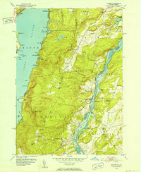
1950 Map of Putnam
USGS Topo · Published 1988About this map
The Adirondack State Park meets the shores of Lake George and Lake Champlain in this 1950 field check of Washington County. This narrow corridor of land between the lakes is defined by the steep slopes of Spruce Mtn and Hogback Mtn, where the Delaware and Hudson railroad tracks parallel the Lake Champlain shoreline. The settlement of Putnam and its vital Putnam Sta(PO) serve as the primary community hub, supported by local landmarks like the Putnam Ch and Putnam Cem.
Find a feature on this map
70 named features on this map. Tap any name to fly to it.
Don’t see what you’re looking for? This feature index may not catch every label — zoom into the map to look around manually.
Map Details
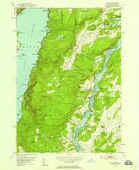
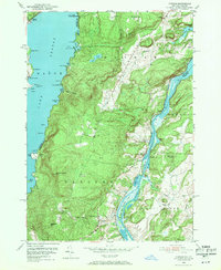
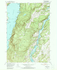
Editions of this 1950 Putnam Map
5 editions found
Other maps of this area

1893 · Whitehall
USGS Topo · 1:62,500

1894 · Ticonderoga
USGS Topo · 1:62,500

1895 · Whitehall
USGS Topo · 1:62,500

1895 · Paradox Lake
USGS Topo · 1:62,500

1896 · Ticonderoga
USGS Topo · 1:62,500

1897 · Bolton
USGS Topo · 1:62,500

1897 · Paradox Lake
USGS Topo · 1:62,500

1898 · Whitehall
USGS Topo · 1:62,500

1900 · Bolton
USGS Topo · 1:62,500

1902 · Whitehall
USGS Topo · 1:62,500