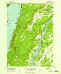
1950 Map of Putnam
USGS Topo · Published 1958About this map
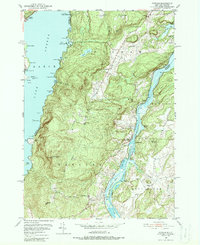
The Adirondack State Park frontier meets the Vermont border in this detailed study of the land between two great lakes. Stretching from the eastern shores of Lake George to the winding channel of Lake Champlain, the terrain is defined by high ridges like Spruce Mtn and Hogback Mtn. Settlement is concentrated along the narrow valley floor, where the Delaware and Hudson railroad tracks parallel the water, connecting small hubs like Putnam Sta (PO) and Dresden Sta (PO).
Find a feature on this map
70 named features on this map. Tap any name to fly to it.
Don’t see what you’re looking for? This feature index may not catch every label — zoom into the map to look around manually.
Map Details
Editions of this 1950 Putnam Map
5 editions found
Other maps of this area

1893 · Whitehall
USGS Topo · 1:62,500

1894 · Ticonderoga
USGS Topo · 1:62,500

1895 · Whitehall
USGS Topo · 1:62,500

1895 · Paradox Lake
USGS Topo · 1:62,500

1896 · Ticonderoga
USGS Topo · 1:62,500

1897 · Bolton
USGS Topo · 1:62,500

1897 · Paradox Lake
USGS Topo · 1:62,500

1898 · Whitehall
USGS Topo · 1:62,500

1900 · Bolton
USGS Topo · 1:62,500

1902 · Whitehall
USGS Topo · 1:62,500