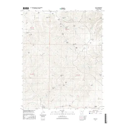
2017 Map of Pyatt
USGS Topo · Published 2017About this map
Crooked Creek meanders across the southern reach of this terrain, anchoring the settlement of Pyatt, where residential streets like Bradford St and Forsyth St meet the water. This 2017 survey reveals a landscape deeply incised by drainages and hollows, including Mining House Hollow and Sand Spring Hollow, which speak to the area's historical land use and natural springs. Further north, the community of Dodd City is situated near the Dodd City Cem, while other family and local burial sites like Derryberry Cem and Jaybird Cem are scattered across the higher elevations. The network of county roads, such as Co Rd 3021, connects these dispersed communities, tracing paths through geographic landmarks like Linton Ridge and Pine Flat. The map effectively captures the interface between the bottomlands of Sugar Orchard Cr and the higher plateaus surrounding Lakeway.
Find a feature on this map
108 named features on this map. Tap any name to fly to it.
Don’t see what you’re looking for? This feature index may not catch every label — zoom into the map to look around manually.
Map Details
Editions of this 2017 Pyatt Map
This is the sole edition of this map. No revisions or reprints were ever made.
Other maps of this area

1893 · Yellville
USGS Topo · 1:125,000

1903 · Yellville
USGS Topo · 1:125,000

1905 · Yellville
USGS Topo · 1:125,000

1929 · Yellville
USGS Topo · 1:125,000

1945 · Harrison
USGS Topo · 1:250,000

1949 · Harrison
USGS Topo · 1:250,000

1954 · Harrison
USGS Topo · 1:250,000

1958 · Harrison
USGS Topo · 1:250,000

1964 · Harrison
USGS Topo · 1:250,000
1966 · Yellville
USGS Topo · 1:24,000