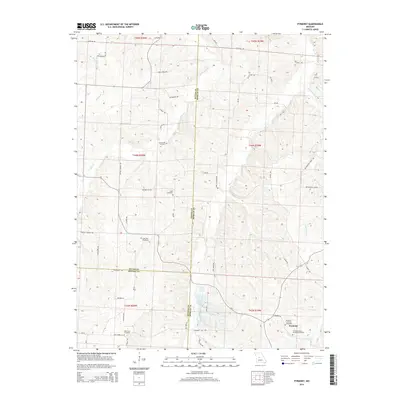
2014 Map of Pyrmont
USGS Topo · Published 2014About this map
Pyrmont serves as the primary focal point in this 2014 survey of the borderlands between Morgan, Pettis, and Benton Counties. The landscape is defined by the winding paths of Haw Cr and Lake Cr, which carve through the terrain and influence the placement of early rural infrastructure. This area is notably dense with genealogical sites, including several small burial grounds that suggest a history of tight-knit agricultural communities. Landmarks such as the Trinity Lutheran Cemetery Pyrmont and Saint Paul Cemetery are preserved alongside a network of local thoroughfares like Butterfield Trail Rd and Ringen School Rd. The convergence of county lines near the southern edge emphasizes the map's role in documenting local jurisdictional boundaries amidst the creek-fed valley topography of central Missouri.
Find a feature on this map
54 named features on this map. Tap any name to fly to it.
Don’t see what you’re looking for? This feature index may not catch every label — zoom into the map to look around manually.
Map Details
Editions of this 2014 Pyrmont Map
This is the sole edition of this map. No revisions or reprints were ever made.
Other maps of this area

1887 · Sedalia
USGS Topo · 1:125,000

1887 · Warsaw
USGS Topo · 1:125,000

1888 · Versailles
USGS Topo · 1:125,000

1888 · Boonville
USGS Topo · 1:125,000

1893 · Versailles
USGS Topo · 1:125,000

1894 · Warsaw
USGS Topo · 1:125,000

1894 · Sedalia
USGS Topo · 1:125,000

1904 · Gravois Mills
USGS Topo · 1:62,500

1944 · Sedalia East
USGS Topo · 1:24,000

1946 · Sedalia East
USGS Topo · 1:24,000