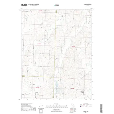
2017 Map of Pyrmont
USGS Topo · Published 2017About this map
Pyrmont serves as the focal point for this rural landscape at the intersection of Morgan, Pettis, and Benton counties. The map reveals a deeply rooted German Lutheran heritage, marked by numerous religious sites such as Pyrmont Lutheran Cem and Trinity Lutheran Cem Pyrmont. These landmarks, along with Saint Paul Lutheran Cem and Lamb Immanuel Cem, indicate a settlement pattern defined by small, community-centered churchyards scattered across the upland drainage divides.
Find a feature on this map
68 named features on this map. Tap any name to fly to it.
Don’t see what you’re looking for? This feature index may not catch every label — zoom into the map to look around manually.
Map Details
Editions of this 2017 Pyrmont Map
This is the sole edition of this map. No revisions or reprints were ever made.
Other maps of this area

1887 · Sedalia
USGS Topo · 1:125,000

1887 · Warsaw
USGS Topo · 1:125,000

1888 · Versailles
USGS Topo · 1:125,000

1888 · Boonville
USGS Topo · 1:125,000

1893 · Versailles
USGS Topo · 1:125,000

1894 · Warsaw
USGS Topo · 1:125,000

1894 · Sedalia
USGS Topo · 1:125,000

1904 · Gravois Mills
USGS Topo · 1:62,500

1944 · Sedalia East
USGS Topo · 1:24,000

1946 · Sedalia East
USGS Topo · 1:24,000