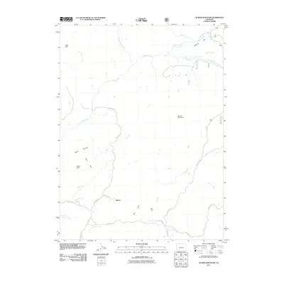
2011 Map of Quaker Mountain
USGS Topo · Published 2011About this map
Elkhead serves as the primary reference point in this high-altitude landscape where the complex drainage network of Northwest Colorado takes center stage. The terrain is defined by prominent peaks and ridges including Baldy Peak, Agner Mountain, and the namesake Quaker Mountain. Water management and natural hydrology are intertwined, evidenced by the McKinley Ditch Number 2 and the meandering paths of Elkhead Creek and its many tributaries such as Dry Fork Elkhead Creek and Hole-in-the-Wall Creek.
Find a feature on this map
29 named features on this map. Tap any name to fly to it.
Don’t see what you’re looking for? This feature index may not catch every label — zoom into the map to look around manually.
Map Details
Editions of this 2011 Quaker Mountain Map
This is the sole edition of this map. No revisions or reprints were ever made.
Other maps of this area

1923 · Elkhead Creek
USGS Topo · 1:62,500

1923 · Pilot Knob
USGS Topo · 1:62,500

1924 · Elkhead Creek
USGS Topo · 1:62,500

1925 · Pilot Knob
USGS Topo · 1:62,500

1954 · Craig
USGS Topo · 1:250,000

1957 · Craig
USGS Topo · 1:250,000

1958 · Craig
USGS Topo · 1:250,000

1960 · Craig
USGS Topo · 1:250,000

1962 · Craig
USGS Topo · 1:250,000
1962 · Bears Ears Peaks
USGS Topo · 1:24,000