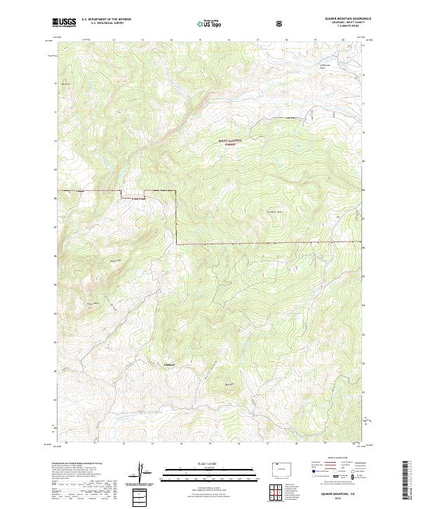
2022 Map of Quaker Mountain
USGS Topo · Published 2022About this map
Elkhead serves as a central reference point in this high-elevation landscape within the Routt National Forest. The terrain is defined by prominent peaks and ridges, including Baldy Peak, Quaker Mtn, and Aigner Mtn, which overlook a network of seasonal and perennial drainages. Notable watercourses such as Elkhead Cr and the Dry Fork Elkhead Cr carve through the topography, feeding into broader valleys like California Park. The map documents a sparsely populated region primarily characterized by Forest Service access and ranching roads, such as Co RD 56 and Co RD 80. This survey provides a modern view of land management and natural landmarks like Finger Rock and Bull Hill, illustrating the enduring character of northwestern Colorado's high country.
Find a feature on this map
30 named features on this map. Tap any name to fly to it.
Don’t see what you’re looking for? This feature index may not catch every label — zoom into the map to look around manually.
Map Details
Editions of this 2022 Quaker Mountain Map
This is the sole edition of this map. No revisions or reprints were ever made.
Other maps of this area

1923 · Elkhead Creek
USGS Topo · 1:62,500

1923 · Pilot Knob
USGS Topo · 1:62,500

1924 · Elkhead Creek
USGS Topo · 1:62,500

1925 · Pilot Knob
USGS Topo · 1:62,500

1954 · Craig
USGS Topo · 1:250,000

1957 · Craig
USGS Topo · 1:250,000

1958 · Craig
USGS Topo · 1:250,000

1960 · Craig
USGS Topo · 1:250,000

1962 · Craig
USGS Topo · 1:250,000
1962 · Bears Ears Peaks
USGS Topo · 1:24,000