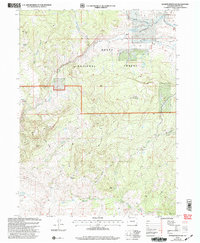
2000 Map of Quaker Mountain
USGS Topo · Published 2004About this map
Routt National Forest dominates this high-altitude terrain at the turn of the millennium, defined by a network of drainage basins and prominent summits. The landscape is structured by the southward flow of Elkhead Creek and its many tributaries, including Hole-in-the-Wall Creek and Stukey Creek, which carve through the high plateaus of California Park. Land use is indicated by the presence of several corrals and a series of drill holes, suggesting a mix of livestock management and resource exploration.
Find a feature on this map
24 named features on this map. Tap any name to fly to it.
Don’t see what you’re looking for? This feature index may not catch every label — zoom into the map to look around manually.
Map Details
Editions of this 2000 Quaker Mountain Map
This is the sole edition of this map. No revisions or reprints were ever made.
Other maps of this area

1923 · Elkhead Creek
USGS Topo · 1:62,500

1923 · Pilot Knob
USGS Topo · 1:62,500

1924 · Elkhead Creek
USGS Topo · 1:62,500

1925 · Pilot Knob
USGS Topo · 1:62,500

1954 · Craig
USGS Topo · 1:250,000

1957 · Craig
USGS Topo · 1:250,000

1958 · Craig
USGS Topo · 1:250,000

1960 · Craig
USGS Topo · 1:250,000

1962 · Craig
USGS Topo · 1:250,000
1962 · Bears Ears Peaks
USGS Topo · 1:24,000