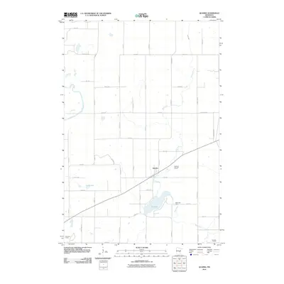
2010 Map of Quamba
USGS Topo · Published 2010About this map
Quamba serves as the central hub of this eastern Minnesota landscape, situated at the intersection of local routes and the winding Mud Creek. The 2010 geography is defined by its significant water bodies and drainage patterns, specifically the Snake River in the west and the expansive Mud Lake to the south. An interesting piece of local infrastructure is the Mud Lake Dam, which regulates the waters before they continue through the marshy lowland corridors. The rural grid is dotted with recreational spaces like the Highland Park Golf Course and the Mora Golf Course at the southwestern edge, reflecting a shift toward leisure land use in the modern era. For those tracing local heritage, the Henriette Cemetery provides a specific point of genealogical interest in the southeastern corner of the quadrangle, while names like Luchts Lake preserve the identities of earlier residents in the terrain.
Find a feature on this map
41 named features on this map. Tap any name to fly to it.
Don’t see what you’re looking for? This feature index may not catch every label — zoom into the map to look around manually.
Map Details
Editions of this 2010 Quamba Map
This is the sole edition of this map. No revisions or reprints were ever made.
Other maps of this area

1953 · Duluth
USGS Topo · 1:250,000

1953 · Stillwater
USGS Topo · 1:250,000

1955 · Stillwater
USGS Topo · 1:250,000

1958 · Stillwater
USGS Topo · 1:250,000

1958 · Duluth
USGS Topo · 1:250,000

1961 · Brook Park
USGS Topo · 1:62,500

1965 · Stillwater
USGS Topo · 1:250,000

1968 · Mora North
USGS Topo · 1:24,000

1968 · Pomroy Lake
USGS Topo · 1:24,000

1968 · Warman
USGS Topo · 1:24,000