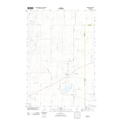
2013 Map of Quamba
USGS Topo · Published 2013About this map
The unincorporated community of Quamba serves as the central point of this 2013 survey, situated along MN-23 as it cuts through the glaciated plains of east-central Minnesota. The landscape is defined by its drainage patterns, notably the winding Mud Cr which feeds into the sizable Mud Lake, and the presence of Luchts Lake to the west. This area on the Kanabec and Pine County line maintains a rural character dominated by a grid of agricultural roads, including Sod Rd and 280th Ave. Significant local landmarks like the Henriette Cem and recreational spaces such as the Highland Park Golf Course provide clear points of reference for genealogists and local historians tracking the development of these small prairie townships in the early 21st century.
Find a feature on this map
40 named features on this map. Tap any name to fly to it.
Don’t see what you’re looking for? This feature index may not catch every label — zoom into the map to look around manually.
Map Details
Editions of this 2013 Quamba Map
This is the sole edition of this map. No revisions or reprints were ever made.
Other maps of this area

1953 · Duluth
USGS Topo · 1:250,000

1953 · Stillwater
USGS Topo · 1:250,000

1955 · Stillwater
USGS Topo · 1:250,000

1958 · Stillwater
USGS Topo · 1:250,000

1958 · Duluth
USGS Topo · 1:250,000

1961 · Brook Park
USGS Topo · 1:62,500

1965 · Stillwater
USGS Topo · 1:250,000

1968 · Mora North
USGS Topo · 1:24,000

1968 · Pomroy Lake
USGS Topo · 1:24,000

1968 · Warman
USGS Topo · 1:24,000