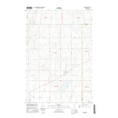
2016 Map of Quamba
USGS Topo · Published 2016About this map
Quamba sits at the intersection of local routes in this pocket of eastern Minnesota, serving as the primary hub within a landscape defined by extensive wetlands and glacial drainage patterns. The settlement is positioned near the meandering Mud Cr, which flows toward the expansive Mud Lake. The terrain is marked by a transition between Kanabec Co and Pine Co, with the Snake River cutting through the western portion of the region. Local land use is evidenced by a grid of rural roads and section lines, including Co RD 5 and Co RD 70, which connect isolated farmsteads and natural features like Luchts Lake. In the southeastern corner, the Henriette Cem provides a point of genealogical interest, situated near the boundary where the township lines of t39n r23w and t39n r22w meet.
Find a feature on this map
59 named features on this map. Tap any name to fly to it.
Don’t see what you’re looking for? This feature index may not catch every label — zoom into the map to look around manually.
Map Details
Editions of this 2016 Quamba Map
This is the sole edition of this map. No revisions or reprints were ever made.
Other maps of this area

1953 · Duluth
USGS Topo · 1:250,000

1953 · Stillwater
USGS Topo · 1:250,000

1955 · Stillwater
USGS Topo · 1:250,000

1958 · Stillwater
USGS Topo · 1:250,000

1958 · Duluth
USGS Topo · 1:250,000

1961 · Brook Park
USGS Topo · 1:62,500

1965 · Stillwater
USGS Topo · 1:250,000

1968 · Mora North
USGS Topo · 1:24,000

1968 · Pomroy Lake
USGS Topo · 1:24,000

1968 · Warman
USGS Topo · 1:24,000