2022 Map of Quamba
USGS Topo · Published 2022About this map
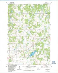
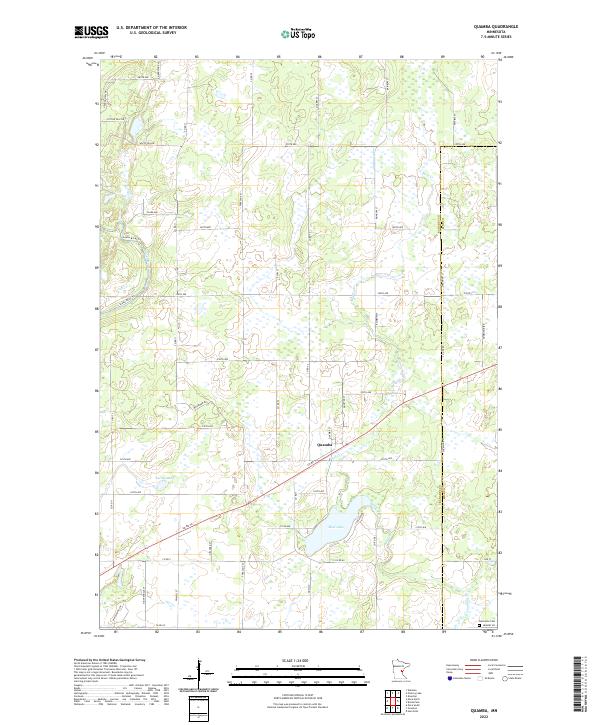
Quamba serves as the primary hub of this landscape, situated along a network of county roads that crisscross the wetlands and lowlands of the Kanabec Co and Pine Co line. The terrain is defined by a dense system of water bodies and drainage, including the winding Snake River to the west and the expansive Mud Lake to the south. Historically significant landmarks like Henriette Cem in the southeastern corner provide valuable touchpoints for genealogists and local historians tracking early settlers in this pocket of eastern Minnesota.
Find a feature on this map
57 named features on this map. Tap any name to fly to it.
Don’t see what you’re looking for? This feature index may not catch every label — zoom into the map to look around manually.
Map Details
Editions of this 2022 Quamba Map
This is the sole edition of this map. No revisions or reprints were ever made.