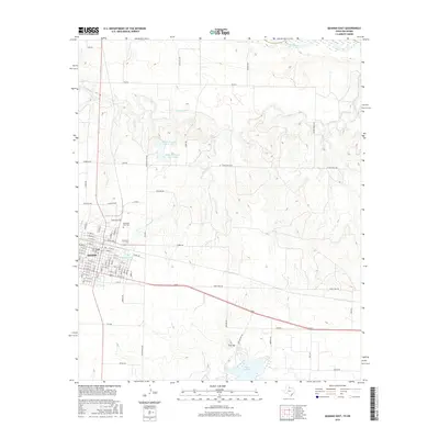
2016 Map of Quanah East
USGS Topo · Published 2016About this map
Quanah serves as the focal point of this landscape, situated south of the Red River in North Texas. The street grid of the town is detailed through major thoroughfares like E Nelson St and W Front St, extending toward the Memorial Park Cem on the northern outskirts. The surrounding terrain is defined by a network of drainage systems, including Groesbeck Cr and Spring Cr, which feed into local impoundments. To the southeast, Lake Pauline and the City of Quanah Lake represent significant water management features in this semi-arid region. Rural infrastructure is well-documented through a web of ranch roads such as Wilson Ranch Rd and Hyson Wells Rd, reflecting the area's agricultural and ranching foundations. The elevation reaches a distinct high point at Flat Top, overlooking the rolling plains that characterize the Hardeman County countryside.
Find a feature on this map
88 named features on this map. Tap any name to fly to it.
Don’t see what you’re looking for? This feature index may not catch every label — zoom into the map to look around manually.
Map Details
Editions of this 2016 Quanah East Map
This is the sole edition of this map. No revisions or reprints were ever made.
Other maps of this area

1927 · Quanah 3-a
USGS Topo · 1:48,000

1932 · Vivian
USGS Topo · 1:62,500

1955 · Lawton
USGS Topo · 1:250,000

1958 · Medicine Mound
USGS Topo · 1:62,500

1960 · Goodlett
USGS Topo · 1:62,500

1960 · Teacup Mountain
USGS Topo · 1:62,500

1960 · Quanah
USGS Topo · 1:62,500

1975 · Quanah NE
USGS Topo · 1:24,000

1975 · Quanah NW
USGS Topo · 1:24,000

1983 · Big Mound
USGS Topo · 1:24,000