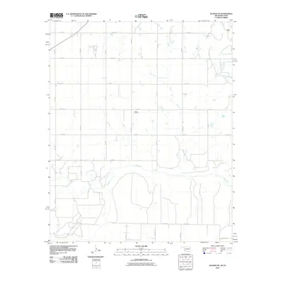
2010 Map of Quanah NE
USGS Topo · Published 2010About this map
The Red River defines the southern portion of this landscape, meandering through Jackson County as it marks the boundary between Oklahoma and Texas. This agricultural terrain is partitioned by a strict grid of section-line roads, such as E1770 Rd and N1900 Rd, which facilitate movement between rural homesteads and fields. The presence of the Odema Cemetery near the center of the sheet serves as a quiet record of the area's pioneer generations, while the Walker Quarry in the northeast corner points to the region's extraction industry.
Find a feature on this map
24 named features on this map. Tap any name to fly to it.
Don’t see what you’re looking for? This feature index may not catch every label — zoom into the map to look around manually.
Map Details
Editions of this 2010 Quanah NE Map
This is the sole edition of this map. No revisions or reprints were ever made.
Other maps of this area

1955 · Lawton
USGS Topo · 1:250,000

1958 · Elmer
USGS Topo · 1:62,500

1960 · Quanah
USGS Topo · 1:62,500

1964 · Olustee
USGS Topo · 1:24,000

1971 · Duke SW
USGS Topo · 1:24,000

1971 · Prairie Hill
USGS Topo · 1:24,000

1975 · Quanah NE
USGS Topo · 1:24,000

1975 · Quanah NW
USGS Topo · 1:24,000
1984 · Quanah NE
USGS Topo · 1:24,000
1984 · Quanah East
USGS Topo · 1:24,000