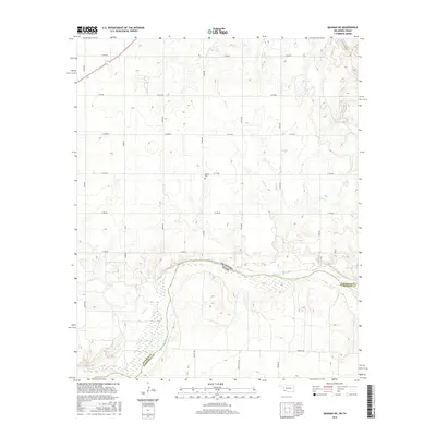
2016 Map of Quanah NE
USGS Topo · Published 2016About this map
The Red River defines the southern boundary of this region, separating the borderlands of Oklahoma and Texas. On the northern banks within Jackson County, the landscape is marked by a grid of rural section roads, including E1770 Rd and Thrash Rd, which facilitate access across the open plains. A notable site for local family historians is the Odema Cem, situated centrally among the agricultural fields. The drainage pattern is shaped by intermittent waterways like Mule Cr and Sandy Cr, which flow toward the river valley. This survey illustrates a quiet, sparsely populated border region where land use is dictated by the confluence of major river systems and a systematic road network.
Find a feature on this map
13 named features on this map. Tap any name to fly to it.
Don’t see what you’re looking for? This feature index may not catch every label — zoom into the map to look around manually.
Map Details
Editions of this 2016 Quanah NE Map
This is the sole edition of this map. No revisions or reprints were ever made.
Other maps of this area

1955 · Lawton
USGS Topo · 1:250,000

1958 · Elmer
USGS Topo · 1:62,500

1960 · Quanah
USGS Topo · 1:62,500

1964 · Olustee
USGS Topo · 1:24,000

1971 · Duke SW
USGS Topo · 1:24,000

1971 · Prairie Hill
USGS Topo · 1:24,000

1975 · Quanah NE
USGS Topo · 1:24,000

1975 · Quanah NW
USGS Topo · 1:24,000
1984 · Quanah NE
USGS Topo · 1:24,000
1984 · Quanah East
USGS Topo · 1:24,000