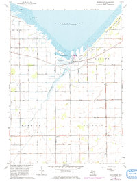
1963 Map of Quanicassee
USGS Topo · Published 1973About this map
Saginaw Bay defines the northern edge of this coastal landscape, where the Quanicassee River empties into the bay through the extensive Quanicassee Marsh. The small community of Quanicassee sits at the bridge crossing between Hampton and Wisner townships, serving as a gateway to the Quanicassee Wildlife Area. To the east, Vanderbilt Park and the Fish Point Wildlife Area occupy the shoreline near Long Point and Coryeon Point.
Find a feature on this map
42 named features on this map. Tap any name to fly to it.
Don’t see what you’re looking for? This feature index may not catch every label — zoom into the map to look around manually.
Map Details
Editions of this 1963 Quanicassee Map
2 editions found
Other maps of this area

1916 · Bay City
USGS Topo · 1:62,500

1919 · Bay City
USGS Topo · 1:62,500

1919 · Saginaw
USGS Topo · 1:62,500

1941 · Saginaw
USGS Topo · 1:62,500

1943 · Bay City
USGS Topo · 1:62,500

1943 · Saginaw
USGS Topo · 1:62,500

1954 · Flint
USGS Topo · 1:250,000

1958 · Flint
USGS Topo · 1:250,000

1963 · Quanicassee
USGS Topo · 1:24,000

1963 · Fish Point
USGS Topo · 1:24,000