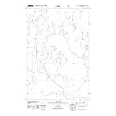
2011 Map of Quartz Mountain
USGS Topo · Published 2011About this map
Quartz Mountain and Jasper Mountain dominate this corner of Bonner County, where the high-elevation terrain is defined by a dense network of forestry roads and drainage systems. The landscape transitions from the peaks down to the Lower West Branch Priest River, which is fed by numerous tributaries including Snow Creek, Kavanaugh Creek, and Peewee Creek. Small settlement clusters appear at Four Corners and Snow Valley, providing points of reference in an otherwise primarily wilderness and timber-management area. A notable concentration of natural features occurs along the river, including Waterfalls and the named Torrelle Falls. The map reveals the intricate access required for this terrain, showing the connection of Quartz Mtn Rd and Johnson Rd as they navigate the ridges and creek valleys near Cottonwood Point.
Find a feature on this map
82 named features on this map. Tap any name to fly to it.
Don’t see what you’re looking for? This feature index may not catch every label — zoom into the map to look around manually.
Map Details
Editions of this 2011 Quartz Mountain Map
This is the sole edition of this map. No revisions or reprints were ever made.
Other maps of this area

1901 · Sandpoint
USGS Topo · 1:125,000

1911 · Priest Lake
USGS Topo · 1:250,000

1911 · Sandpoint
USGS Topo · 1:125,000

1913 · Priest Lake
USGS Topo · 1:250,000

1936 · Newport
USGS Topo · 1:96,000

1942 · Newport
USGS Topo · 1:125,000

1958 · Sandpoint
USGS Topo · 1:250,000

1963 · Sandpoint
USGS Topo · 1:250,000

1967 · Quartz Mtn
USGS Topo · 1:24,000

1967 · Coolin
USGS Topo · 1:24,000